3D Modelling of Proposed Lake Design - Informed by Aerial Survey to Support a Flood Risk Assessment
Site Assessments Geomatics for Construction & Asset Management Flood Risk
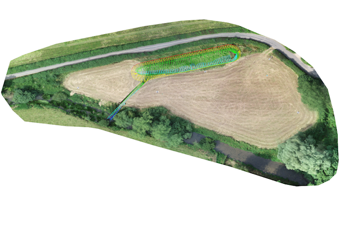
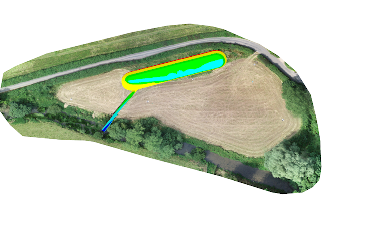
Environment Agency flood level comparison with geo-located Aerial Survey data was the starting point for this assessment. 3D modelling of the lake design came alive with the digital site twin imagery, and precision cut/fill analysis was achievable via the aerial point cloud density. Project outputs provided clarity in the proposals for regulators, whilst the 3D design accuracy also informed the cost plan.
Project:An aerial topographic survey to determine site level data to support a flood risk assessment associated with the proposed development of a lake within a floodplain.
Nature of site: The project site is a small field, circa 1Ha, bounded by a road and a main river. The site is located on floodplain.
Scope: 3D-CAD plans, web-hosted 3D interrogatable digital site model and FRA, all part of the service.
Client: Private client
Duration of Works: 1 week - Aerial survey work, 3D Modelling and Report Presentation
Value: 3K