Aerial topographic survey to support 3D cut/fill modelling and residential masterplanning
Geomatics for Construction & Asset Management
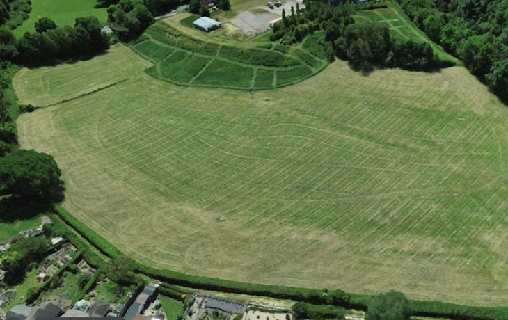
An aerial topographic survey was undertaken to provide geolocated base information for development design and to support 3D cut/fill modelling. With the use of powerful modelling software an accurate ground level was determined for the site - even in densely vegetated areas. The fast, safe, and accurate aerial method for topographic data collection, coupled with outputs in CAD and digital site twin via a web-hosted portal, allowed for multiple benefits for the client team during master Planning – all achievable at a lower cost than traditional survey methods.
Project: High resolution ground level information was required to assist in Master Plan design for a large residential development. Topographic information, along with a 3D Digital Terrain Model (DTM) of current ground levels, was needed to compare against proposed design options. Using 3D specialist earthworks modelling software, 2D proposed designs were converted into 3D and further DTMs created to allow comparative cut/fill calculations and Master Plan options to be reviewed – all with the benefit of real 3D digital site viewing.
Nature of site: Approximately 5ha site of mainly open farmland, a large bund, an adjacent industrial development - all bordered by highway and existing residential properties. Complexity of the variation in terrain and vegetation made this project challenging.
Scope: Aerial topographic survey of large proposed residential development site to provide topographic data as well as 3D Digital Terrain Model. Ground investigation was undertaken as part of the works and the data incorporated to the model.
Client: Housing developer
Duration of Works: 1 Week – Aerial survey work; 3 weeks – 3D modelling of three different proposed designs
Value: £6500