Stockpile Volumetrics - Aerial Survey and Cut/fill Modelling to support Construction Phase Earthworks Movement
Site Assessments Geomatics for Construction & Asset Management
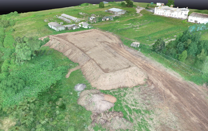
An aerial survey was conducted on an active construction site to provide data on stockpile volumes and cut/fill volumetrics on a newly stripped earthworks area. The purpose of the assessment was geared to cost control and assisting in the management of the earthworks contractor. The resultant 3D digital site model however, also gave the project team much more additional data to carry out virtual site visits and view/interrogate other information, including creation of a surface water bund and local highways data.
Project: Aerial survey and cut/fill modelling to support construction phase earthworks movement.
Nature of site: The site is a c.20Ha site located in a semi rural area at construction stage for a residential development.
Scope: Aerial survey, stockpile volume calculations and 3D modelling to determine stripped area cut volume, as a check against the stockpile volumes. 3D-CAD plans and web-hosted 3D interrogatable digital site model, all part of the service.
Client: Residential developer
Duration of works: 1 week
Value: Approx. £3500