Radon map update – check your development’s radon status
UK Health Security Agency (UKHSA) is responsible for protecting UK residents from various health threats from infectious diseases to chemical incidents. UKHSA also oversee UKradon, which aims to manage radon risk through the publication of radon ‘Affected Area’ maps for the whole of the UK. Although the natural geological sources of radon gas in the UK have been unchanged for thousands, if not millions of years, the UKHSA does occasionally update the maps and they can change quite significantly. This has happened before in 2007 and more recently in December 2022.
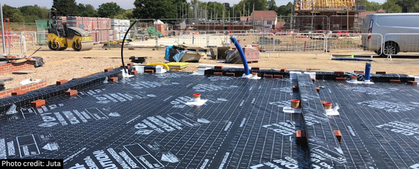
Radon gas is formed through the natural decay of certain elements in rocks and soils, and is believed to be harmful to human health. The primary risk is through the inhalation of radon gas in our homes. Depending on which part of the country we are looking at, the radon maps provide a classification for the likelihood of properties in that area being exposed to radon above a defined action level. The classification the land falls in also defines whether radon protection measures (such a sub-floor membranes) need to be incorporated into a building. Most environmental site investigation reports would reference these classifications, including those done by EPS.
If you have an environmental site investigation report that pre-dates December 2022, we advise you to check this aspect of your project and building design to ensure the maps have not changed sufficiently in the interim to now warrant the inclusion or omission of radon gas protection.
If you wish to discuss this aspect of your report with us please contact Marcus Bell via email or telephone. We can arrange a formal addendum to your report to provide an up-to-date risk review for radon gas if necessary. You may also wish to consult your approved inspector/building control team as they typically regulate the installation of radon protection.
For further information visit: https://www.ukradon.org/