How EPS Manage and Make Use of Data (a.k.a check out the cool 360 site photo!)
Recently we have seen significant benefits in combining data collected from our drone and high-precision GPS. These benefits are much welcomed by some of our older and more experienced consultants / engineers who remember having to manually convert coordinates to different coordinate systems and make sure that the projections are all compatible with relevant mapping.
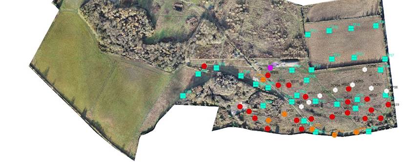
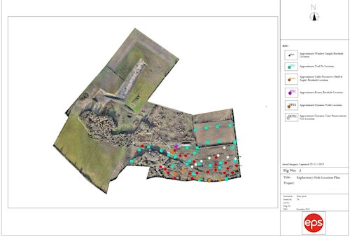
These days with a few taps of the screen on your compatible smart phone and a few clicks of the mouse in a GIS program all of our boreholes, trial pits, stockpiles, and any other interesting features can be plotted onto a map within minutes. Couple this with site specific aerial photography and elevation data collected by our drone and we’re able to create the most up to date and accurate site plans possible.
When we marry up all of this data with site specific information on ground conditions we’re able to create a seamless workflow using our preferred program for geotechnical data management to visualise how ground conditions differ throughout a site allowing us to better conceptualise the geology beneath our feet and come up with the right solutions for those often complex issues such as materials management and outline foundation design.
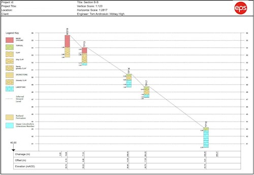
The images within this blog post are from an investigation recently completed on a site in Lincolnshire where we expect to be involved for the next few years as the area is developed into a large residential scheme / urban extension. Tackling problems ranging from contamination to low strength soils at brownfield sites such as these is our bread and butter work and having the means to collect, manage and interpret the wealth of data generated from investigating such areas makes our jobs much more interesting.
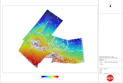
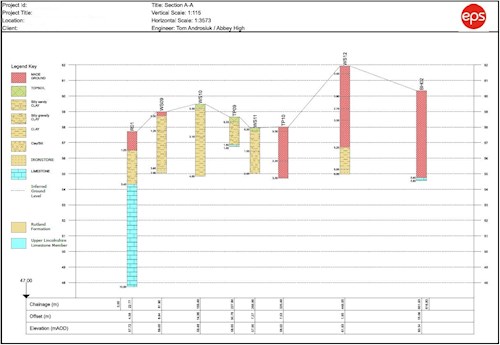
On this particular site we’ve been able to tie together topographic data with some cross sections to show the variation in ground conditions which helps to ‘zone’ the site, highlighting potential options for altering levels to suit the needs of the development. In turn we’re also able to estimate the volumes of potential waste streams in order to help reduce the need for importing material during the construction phase thereby reducing emissions and saving money.
Being able to manage large data sets from investigations such as this also allows us to collaborate with our clients and project teams so that other documents can be prepared from the findings of our work such as environmental statements, environmental impact assessments and design and access statement.
If you'd like to find out more about anything we mentioned above, please get in touch with Tom.